Illustration by Armine Shahbazyan.
“We live in a world populated by structures — a complex mixture of geological, biological, social, and linguistic constructions that are nothing but accumulations of materials shaped and hardened by history. Immersed as we are in this mixture, we cannot help but interact in a variety of ways with the other historical constructions that surround us, and in these interactions, we generate novel combinations, some of which possess emergent properties. In turn, these synergistic combinations, whether of human origin or not, become the raw material for further mixtures. This is how the population of structures inhabiting our planet has acquired its rich variety, as the entry of novel materials into the mix triggers wild proliferation of new forms.”
- Manuel De Landa, “A Thousand Years of Nonlinear History”
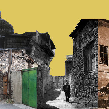
There is certainly no lack of texts written about the district of Kond – the oldest surviving vernacular area in Yerevan. A wide range of literature is available that highlights Kond’s cultural, historical, symbolic and political significance. However as it often happens, by the time these texts reach the stage when Kond must be examined as a material structure, all critical vigor is already exhausted. Thus, a big portion of the literature available on Kond ends up being descriptive, but not necessarily analytical in nature. Within the context of this article, it will be illustrated that Kond’s significance lies not in the current cultural, social and political interpretations but rather in this district’s capacity to store and transfer information across generations. Kond will be analyzed primarily as an information ‘storage device’ shaped and hardened by history.
The etymology of the word “Kond” can be traced back to a multitude of different origins and meanings. However, what seems to be unchanged in all the different interpretations is a reference to some kind of rock formation. In the mountainous region of Armenia rocks are perhaps the most commonly encountered and least exciting objects. However, if you ask any geologist, you’ll quickly learn that there are no ordinary rocks. Even the most common rock contains an abundance of information about its formation process. Every layer within the rock carries information about the environmental, geological, and volcanic processes at the time of its formation. The task of the geologist is to decode and extract information embedded in the varying layers of the artefact and construct a holistic picture of the time period. Shredding the rock into dust would make the retrieval of this information an immensely difficult, if not impossible endeavour. Thus, it would be natural to assume that information is stored in the structural relations present within the rock, rather than the particles that constitute it.
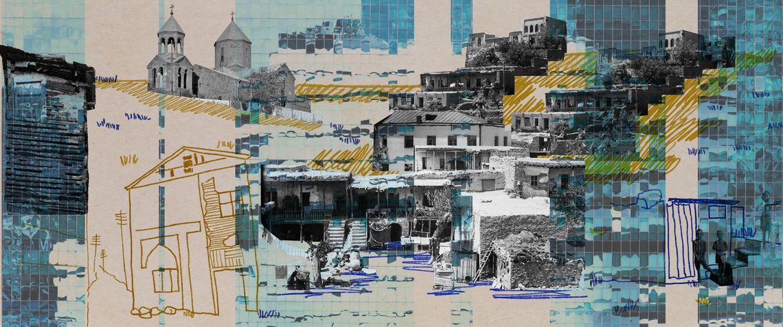
While geological formations owe their creation to various volcanic processes, human habitats are created as a byproduct of anthropogenic (man-made) processes. Kond’s physical structure, for instance, emerged as a recurring pattern of human habitation within a specific geographic area. Its physical form was shaped by the cultural, economic and social forces flowing through the organism of the city. Once a persistent form emerged and hardened, it started to act as a regulator for the very same forces that shaped it. Kond’s every historical “stratum” carries distinct information about the interaction between its physical form and the historical processes that acted upon it. Looking at the varying layers of the habitat and their relationships to each other allows future generations to retrieve the embedded information and generate novel interpretations regarding a specific time period and the paradigms inherent to it.
Surely, in the era of cloud technologies, rocks and buildings might not sound like very effective devices for information storage. Nowadays, we are accustomed to thinking about information as an immaterial and abstract entity floating in a vacuum and we often tend to forget that information always requires a physical vessel to act as a carrier. Ancient civilisations have used rocks to store and transfer information since the beginning of the millennia. Information inscribed on the surface of rock could outlive its creators and communicate across time. The cuneiform writings found on the walls of the Erebuni castle are one example of this resilient information storage method. Cuneiform’s systematic subtraction of matter produces structured voids and the relationships between these voids convey certain information to the observer. This underlying principle can be observed at larger scale in the ancient habitats like Kond where the street network is carved out of the hill producing a complex organisation that engages with the observer. Hence the district does not need writings to communicate; everything it has to communicate is embedded in the architectural, or rather, geometric relationships between the streets and the buildings.
While these two phenomena share similar traits, there is an important difference between them that needs to be emphasised. What sets them apart is not the difference in scale or matter but rather the different structure of their complexity. Influences and systems necessary to produce cuneiform writings are vastly different from those necessary to form a city. Understanding and preserving these complex structural relationships is, therefore, of utmost importance if the information embedded in them is to be passed onto future generations.
The Structure of Kond
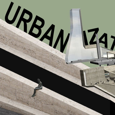
In order to form a better understanding of the geometric relationships present within the district, it is necessary to look at the history of Yerevan. In the first half of twentieth century, the exponential increase in population caused by the refugees of the Armenian Genocide and the rapidly unfolding industrial revolution formed a strong vector for restructuring the city. Several attempts of introducing new organizational principles were made but perhaps the most prominent contribution was the master plan developed by Alexander Tamanian in the third decade of the 20th century. While his proposals changed iteratively throughout the development process, the core idea of the master plan was to introduce a heavily centralized radial city with well defined circular boundaries. Analyses of Tamanyan’s proposal often dedicate an immense amount of attention to Tamanian’s neoclassical stylistic preference, yet overlook the fact that the new master plan was essentially an act of abstraction. It greatly simplified and reduced the complexity of the existing urban reality that it strived to “ameliorate”.
Tamanian’s work replaced the seemingly erratic street network with smooth curves, straight lines and rigid rulesets of axial composition. The proposal had less to do with the physical reality of the historic settlement and more with a projection of abstract ideas onto the city. Naturally, these abstract projections were neither Tamanian’s invention nor did they originate in the field of urban planning. Abstraction is a process inherent to human cognition. Its origin can be traced back to the prehistoric cave paintings and the foundation of mathematics in ancient Western civilizations. Abstraction was also a fundamental component of Eastern, and particularly Islamic traditional visual culture, where ornaments often came to stand for the absence of mimetic, figurative representations of reality and ideas.
Nevertheless, it was modernist art that formulated abstraction into an ideological and visual language for the future. At the beginning of the 20th century, works of Wassili Kandinsky and other pioneers were demonstrating the power of abstraction in visual art. Inevitably, this revolutionary approach began to rapidly infiltrate other fields, including urban planning (constructivist architecture, garden city movement), where Tamanian found the initial inspiration for his proposal. However, it’s important to remember that every abstraction is a form of simplification and its purpose is to reduce/condense the amount of information available. This reduction is performed to sharpen certain aspects of the underlying phenomenon and suppress others. Thus, abstractions fruitfully exist with a degree of independence from the perceived world. This independence is what makes them immensely powerful devices, while also implying the impossibility of reconciliation between the abstractions and the perceived reality (the map is not the territory). Thus, relying on this kind of abstraction might be a viable approach when a city is being designed from scratch, but it creates issues of reconciliation when certain parts of the settlement are already established.
This issue saturates European modernism where the abstractions often had to break historically preserved environments or be isolated from them. Tamanian’s master plan was no exception and when faced with this dilemma it chooses to emphasise the abstraction at the expense of the existing reality. Its implementation selectively erased the large part of the existing street network, numerous churches, the remains of the Erivan fortress and a prominent bazaar that acted as the central, historically-rooted artery of the city. It replaced the complex topology of the street networks with regular grids, reducing the amount of “surplus” information and abiding by the ideas of the modernist automobile-dominated city.
What makes the structure of Kond inherently different from Tamanian’s Yerevan is that Kond avoided this process of information reduction. Kond was not transformed according to Tamanian’s master plan – which aimed to turn this dense web of private houses into a museum district – and as a result, the information embedded in Kond is much older than any other part of the capital. The oldest available maps of the district reveal that despite the often profound transformations, the street system of the suburb remained nearly unchanged throughout its existence. The system of routes and alleys acted as a “DNA” around which different formal articulations were created and destroyed under a multitude of historical and cultural influences. However, the structure of Kond went on undisturbed by abstractions. Thus, its formation process resembles organic self-organization while modern Yerevan is a result of mechanical hierarchical organization. This difference in the formation process caused the structure of Kond’s complexity to be vastly different from the complexities generated by Yerevan’s modernization.
To this day Kond has a distributed, non-hierarchical urban structure. It doesn’t have a formal center. It does not have a specific entry or exit point, main or secondary streets. Kond’s layers are merged and folded into each other both vertically and horizontally. Its spatial structure is formed through embedding while Yerevan remains a product of axial composition and zoning.
Today, Yerevan abides by more traditional and outdated urban planning methods inherited from 20th century abstractions. This is one of the reasons why the district of Kond is viewed as a complicated riddle to a modern urban planner accustomed to looking at things through the lens of flat abstractions (city plans and zoning documents). Due to the specificity of its formation process, the spatial structure of Kond cannot be projected onto the flat plain without significant information loss. Any analysis that attempts to approach Kond’s structure through traditional planar projections is doomed to simplify and erase the information that survived the aftermath of Tamanian’s master plan.
If we believe that Kond is to be part of Yerevan, then there has to be a certain correspondence between the part and the larger whole. Correspondence on a deeper structural level. This correspondence is currently missing and the place where these two vastly different structures meet has become a line of collision – evident in the barrier-like belt of Soviet and post-independence era high-rise buildings that deliberately encircle Kond. There is a need to reconcile these structural differences, however this reconciliation is impossible if Kond is constantly analyzed in isolation from the rest of the city. This is the fundamental flaw of many approaches that attempt to resolve the symptoms apparent in Kond and fail to recognize the underlying structural problems. In order to achieve this reconciliation, it is first important to acknowledge that all information storage is subject to decay through its interactions with the environment.
No matter how resilient the matter, some information will become irretrievable over time. The decay caused by negligence can already be seen in Kond today. Some parts of the district no longer hold any comprehensible message even for the eyes of a geologist or a historian. These decaying artefacts need to be erased to make room for new information to enter the system. However, the introduction of new materials should not corrupt the integrity of the old ones. Hence the preservation of the district's current street structure is of utmost importance.
Throughout its existence, Kond gradually changed its name, size, geographic location, physical boundaries, ethno-religious identity and demographics. However, among these ever-changing characteristics, the fact that the street network remained relatively unchanged allows us to identify Kond and bind its different fragments and time periods together. If everything was changing all the time it would have been impossible to learn anything about the past of the district. What has remained unchanged throughout the tribulations of history, has to remain relatively unchanged. This is an essential condition for relating the Kond of tomorrow to the Kond of the past and allowing future generations to further enrich the district with new interpretations.
Also from our "Et cetera" section
“Where Are You, Soghomon?” Arman Nshanian’s Melodrama About Komitas
By Sona Karapoghosyan
“Songs of Solomon” promises to tell the story of young Komitas but ends up disappointing as the direction drastically changes, turning into another tragic film about the Armenian Genocide and Komitas simply a faded symbol emphasizing a lost culture and history.
Meghri: A Fuselage of Memory
By Tigran Amiryan
There is a Facebook group of Meghri natives that is more active than the official pages of many institutions. It is, however, also isolated, living a separate life, disconnected from the rest of the digital world just like the actual city.
Notes From a Future Museum: Bagging Up Ideologies
By Vigen Galstyan
How a black evening handbag found among countless items in Yerevan’s largest flea market revealed a paradigmatic shift from the egalitarian criteria of Soviet ideology, which accorded functional objects with purely practical properties.
The Cinema Screen: A Political Battlefield
By Sona Karapoghosyan
Mher Mkrtchyan has made a marked and oppositional political film, which, however, is too superficial and collapses under the incredible transparency of its agenda, writes film critic Sona Karapoghosyan.
The EDM Kitchen։ Electronic Dance Music in the Context of Gender
By Eva Khachatryan
Electronic dance music, as a relatively new cultural phenomenon, could have been occupied by women, but even here, the presence of men is predominant and women have to fight for fair representation.
More on Kond and architecture
Kond: A City Within a City
By Arpine Haroyan , Hovhannes Nazaretyan
A tucked away city within a city, the district of Kond in Yerevan has a rich history and a promising future only if authorities undertake a large-scale restoration. What are the stories of Kond and what does the future hold for one of the oldest quarters in the country’s capital?
Heritage and the Contemporary
By Movses Hrayr Der Kevorkian
When emphasizing the preservation of historic structures and their integration into unban life, we should keep in mind that heritage should not be perceived as only architectural heritage and we should not think that it is only the physical heritage that is endangered.
On Urbanization in Armenia: From “City-Building” to Urban Planning
By Garine Boghossian
Development projects are popping up haphazardly in Armenia. Many of them pursued for short-term economic goal under the pretext of development. Without a holistic vision for growth in the country, consequences of decisions taken today will be irreversible for generations to come.


